City Centre Plan
We are updating the City Centre Plan. Head over to the City Centre Plan Update page to learn more and share your input.
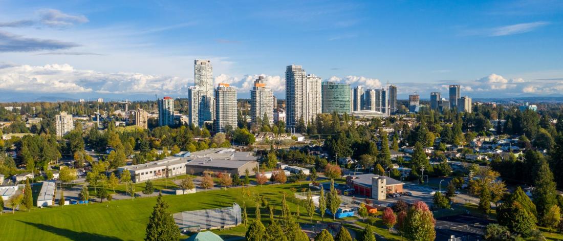
Surrey City Centre is undergoing a significant transformation. What was once a suburban town centre is developing into a walkable, transit-oriented downtown serving south of the Fraser River. In 2017 Council approved the City Centre Plan to guide this process.
As a result, City Centre has been successful in attracting significant investment. This has come in the form of high density residential, commercial, mixed use, and institutional development.
The emerging City Centre is dynamic and ever changing. As such, periodic updates to the plan will ensure it remains relevant.
Get Involved
There have been significant changes in City Centre since the plan was completed. We have begun to update the plan to address these changes. The update will:
- Establish a Central Business District to support office and employment growth,
- Plan for growth around a new SkyTrain station at Fraser Highway at 140 Street,
- Refine land uses in the Bolivar Heights neighbourhood, and
- Review opportunities to provide additional parks and amenities.
Key Documents
- City Centre Plan (2017)
- Interactive Land Use Map (COSMOS)
- Land Use Map (July 25, 2022)
- Construction Standards
- Appendix Documents
- Transportation Impact Assessment (2009)
Plan Area
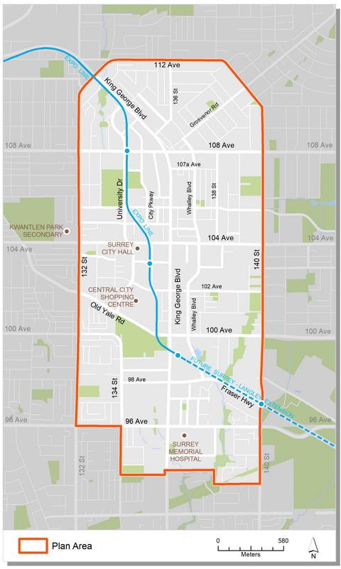
The City Centre plan area is in North Surrey where three major transit corridors come together: King George Boulevard, Fraser Highway and 104 Avenue. It encompasses approximately 570 hectares, making it comparable in size to Vancouver's downtown peninsula (excluding Stanley Park). The boundaries extend from approximately 93A Avenue in the south to 112 Avenue in the north, and from 132nd Street to 140th Street, west to east.
Background Information
The first plan for the City Centre was completed in 1991. Key recommendations of the plan included a concentration of density at SkyTrain stations and the construction of a ring road system. It established the first vision for a compact downtown core.
Development after the adoption of the 1991 plan was sporadic and not always focused around SkyTrain. The resulting development pattern did not create a compact and identifiable City Centre. As a result, in 2003 the Whalley Enhancement Strategy and Urban Design Concept was developed. The goal was to further encourage growth and density around existing transportation and services.
In late 2006 Council endorsed Corporate Report R172 which directed staff to update the vision and plan for downtown Surrey. Over the next decade a comprehensive and phased planning process was undertaken. Staff reported back to Council on many occasions.
In January, 2017, Council endorsed Corporate Report R014 which approved the final City Centre Plan. The plan envisions a vibrant downtown with distinct neighbourhoods, each with its own unique character. The plan also emphasizes high quality transit connections; roads designed to promote safe walking and cycling; abundant parks and plazas; and places for people to live, work, and play.
In October 2019, Council received Corporate Report R205 and authorized staff to undertake a review of the City Centre Plan. The main purpose of the review is to establish a Central Business District and to review land uses around a future SkyTrain station at the edge of the plan area.
Contact Information
Andrew Dong, Community Planner
Community Planning Division
Phone: 604-591-4195
CityCentrePlan@surrey.ca