Highway 99 Corridor Local Area Plan
Learn about the Highway 99 Corridor Local Area Plan.
The Local Area Plan for the Highway 99 Corridor sets out a policy framework for land use and density, a transportation network and an environmental management plan, as well as requirements for servicing, amenities and financing. The planning process for this area was initiated in 2002 and the plan was approved by Council in February 2004.
Plan Area
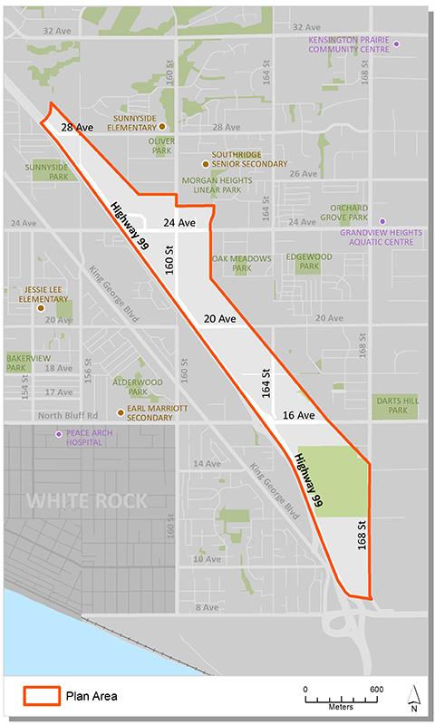
The Highway 99 Corridor is located in south - central Surrey. It includes the lands generally bounded by Highway 99 to the west, the B.C. Hydro right-of-way and 164 Street to the east, 8 Avenue to the south, and Rosemary Heights to the north. The Corridor has a gross area of approximately 158 hectares (390 acres).
Background Information
In 2002, Council endorsed Corporate Report R015, which authorised staff to proceed with a Local Area Plan for the Highway 99 Corridor.
In 2003, after public consultation (including four open houses), a market impact study and separate Traffic Impact and Environmental Assessment studies, Council endorsed Corporate Report C013, approving the Stage 1 land use concept. Council also authorized staff to finalize the Stage 2 component of the Plan.
On February 23, 2004 Council approved the recommendations of Corporate Report L004 to approve the Highway 99 Corridor Local Area Plan.
Key Documents
Contact Information
Planning & Development
planningdevelopment@surrey.ca
604-591-4448
Are you considering developing or rezoning? The first step is a Pre-Application Meeting.