Sunnyside Heights NCP
Find information about Sunnyside Heights Neighbourhood Concept Plan (NCP).
Sunnyside Heights is the name of the second neighbourhood plan area within the broader Grandview Heights community. The planning process for this neighbourhood area was initiated in 2005, and consisted of a series of background studies, a community consultation process and an engineering and servicing strategy. In 2017, Council approved an amendment to the Plan which including land use changes to the south portion of the Plan Area.
This plan, now being implemented, provides direction on the type and density of development, urban design, parks and community amenities and engineering infrastructure for the neighbourhood.
Plan Area
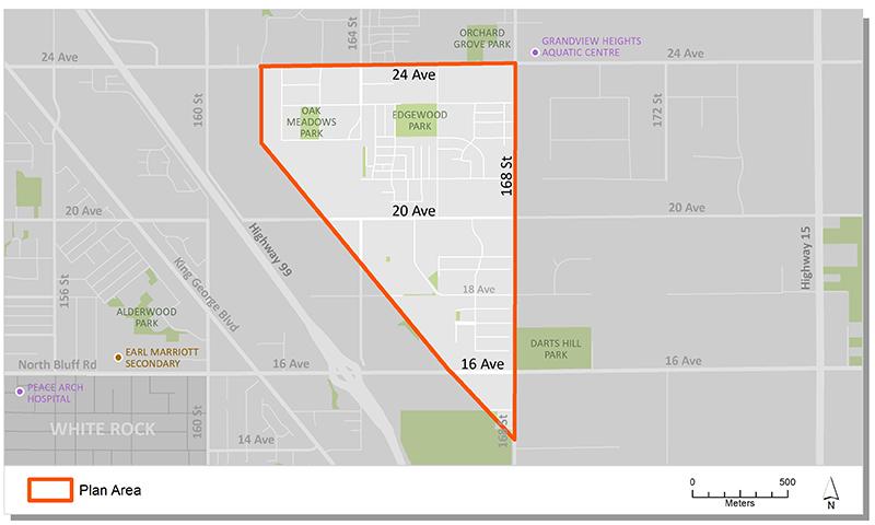
The Sunnyside Heights Neighbourhood Concept Plan (NCP) area is bordered by 168 Street in the East, 24 Avenue in the North and the Highway 99 Corridor Plan in the West. The area to the south is the protected Fergus Watershed Biodiversity Preserve. In total, the plan area encompasses about 153 hectares (379 acres).
Background
In 2003 Council identified Grandview Heights as an area of the City that would be suitable for new development. A General Land Use Plan (GLUP) was approved in 2005 to serve as an overall guide for land use, servicing and development in the area. It also identified the Neighbourhood Concept Planning (NCP) approach to plan future Grandview neighborhoods.
In 2005 Council endorsed Corporate Report R067 which authorized staff to proceed with a Neighbourhood Concept Plan process for the Grandview Heights Area 2 (Sunnyside Heights) neighbourhood.
In 2007, following two years of community consultation, including three open houses, Council endorsed Corporate Report R194 and approved the Stage 1 land use concept. Council also authorized staff to proceed with the Stage 2 component of the Plan.
In 2010, Council endorsed Corporate Report R237 and Corporate Report R236 which approved the Stage 2 Plan and provided a detailed analysis of the planning, engineering and servicing requirements, as well as the financial strategy to implement the plan. It also included the approval of the final plan document and land use concept.
In June 2017, Council endorsed Corporate Report R129 which initiated a review of the approved Stage 2 NCP, with the aim of ensuring consistency between City policies and current development trends.
In December 2017, following a community and stakeholder consultation process, Council endorsed Corporate Report R259 which concluded the plan review and approved an amendment to the south area of the plan.
Key Documents
Contact Information
Planning & Development
planningdevelopment@surrey.ca
604-591-4448
Are you considering developing or rezoning? The first step is a Pre-Application Meeting.