South Westminster Heights Concept Plan
Review the land use plan for the South Westminster Heights neighbourhood of Whalley.
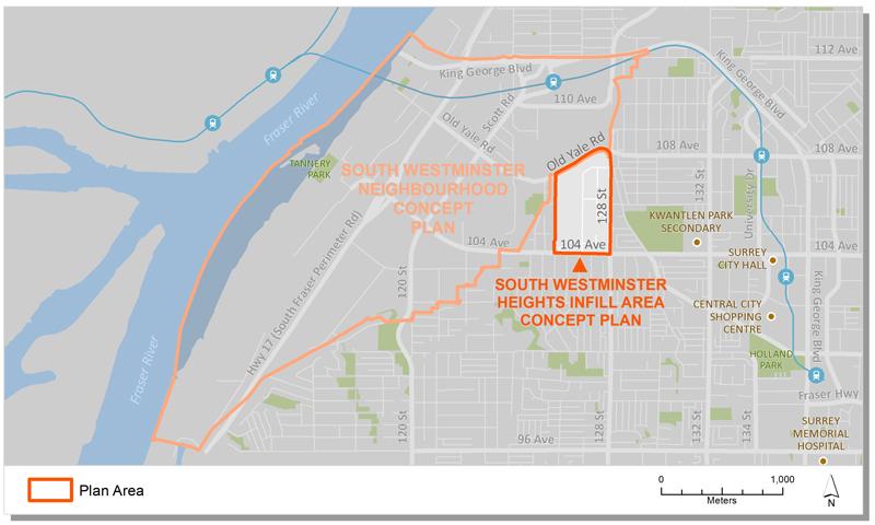
The South Westminster Heights neighbourhood is located to the west of Royal Kwantlen Park, along a ridge line that overlooks South Westminster and the Fraser River.
The neighbourhood is a more traditional single family area with older lots and streets characterized with mature trees. The treed ridge line is clearly visible from New Westminster, the SkyTrain Bridge, the Pattullo Bridge, and other routes into Surrey.
Key Documents
Plan Area
The South Westminster Heights plan area encompasses approximately 30.86 hectares (76.26 acres) in Northwest Whalley. The area is generally bounded by Old Yale Road to the north, 128 Street to the east, 104 Avenue to the south and 125B Street to the west.
Background Information
On November 26, 2012, Council referred a development application in the neighbourhood back to City staff to develop an Infill Concept Plan for a small neighbourhood in Northwest Whalley. Following Council direction, staff undertook an Environmental Study and conducted a community engagement process in support of a new plan for the area.
In July, 2013, Council endorsed Corporate Report R153 which approved the South Westminster Infill Area Concept Plan and Guidelines.
Contact Information
Planning & Development
planningdevelopment@surrey.ca
604-591-4448
Are you considering developing or rezoning? The first step is a Pre-Application Meeting.