Protected Cycling Quick-Build Projects
Learn how we're making cycling safer in Surrey starting with City Centre.
Cycling helps us reduce our carbon footprint, promotes healthy lifestyles and reduces traffic.
To make cycling safer and to encourage more residents to cycle in Surrey, the City is expanding its network of protected cycling routes. This means adding more protected, connected and continuous cycling routes in key locations across the city, starting with Surrey City Centre.
Protected Cycling Routes
Protected cycling routes increase the safety of cyclists through physical separation from other road users. Physical separation can be achieved using things like planter boxes and curbs placed at strategic locations along a road to minimize conflicts between cyclists and cars.
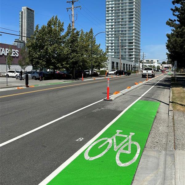
Example of curbs used to protect cyclists from vehicles.
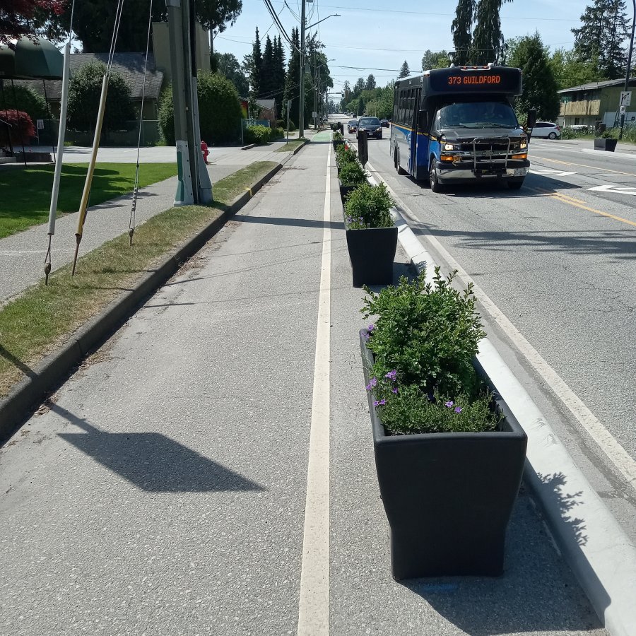
Example of planter boxes used to protect cyclists from vehicles.
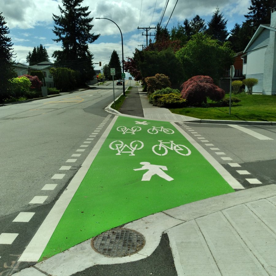
Example of multi-use pathways that protect cyclists from vehicles.
Why is Surrey Building Protected Cycling Paths?
Cycling offers several benefits including:
- giving residents a sustainable travel option as it reduces our carbon footprint;
- promoting healthy lifestyles as it involves physical activity; and
- reducing traffic as it helps get some cars off the road.
Surrey does have an extensive network of cycling routes, with 1,133 lane kilometres of bikeways. However, the 2016 Census showed that Surrey has the lowest cycling mode share in Metro Vancouver at 0.4%.
Why is the cycling mode share so low? Because most of the bikeways in Surrey are painted or shoulder bike lanes on higher speed, higher volume roads and do not provide the protection cyclists need to feel safe. ICBC collision data confirms this, as people who cycle in Surrey are three to four times more likely to be hit by a car than cyclists in Vancouver.
As a result, most of Surrey’s cycling network is designed for a small percent of the population that is comfortable cycling on busy streets without protection from cars and trucks. Recent surveys indicate 60% of residents were interested in cycling more.
To make the cycling network safer, more comfortable and attractive to cyclists, Surrey needs a larger network of cycling routes that is protected, connected and continuous in locations that have the greatest cycling potential – like City Centre.
Project Timeline
In the next five years, 11 kilometres of protected cycling routes are planned to be completed as part of various major Capital Projects in City Centre. They will be built through a combination of road widening projects and cycling-specific projects outlined in Surrey’s 10 Year (2021-2030) Servicing Plan.
Where do we start?
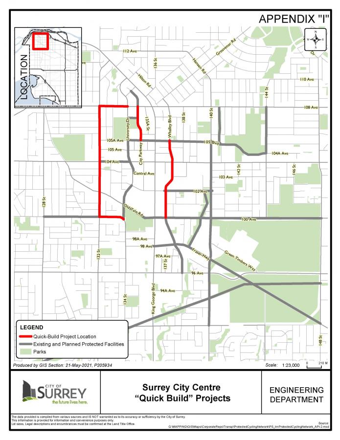
To kickstart this project, we will build 6 kilometres of protected cycling paths using “quick-build” materials.
Starting fall/winter 2021, we will add protected cycling paths on these corridors:
-
132 Street between 100 Avenue and 108 Avenue
-
108 Avenue between 132 Street and University Drive
-
100 Avenue between 132 Street and Holland Park
-
City Parkway between 105A Avenue and 108 Avenue
-
Whalley Boulevard between 100 Avenue and 105A Avenue
We expect these projects will be complete by the end of 2022 or early 2023.
These 6 kilometres of quick-build projects are funded through TransLink cost-sharing funding to support regional cycling investments. This will build on the 9 kilometres already in place, and supplement additional capital projects to result in City Centre having over 26 kilometres of protected cycling routes.
Quick-Build Method
These protected cycling routes will be added to City Centre using the "quick-build" method which are quicker to install and lower cost, working within existing curbs.
The quick-build projects will use a variety of construction methods with a focus on curbs and planters. The projects will be designed to minimize impacts to on-street parking, access to local businesses and transit.
In most cases, quick-build cycling routes are temporary and will be replaced with more permanent construction through upcoming capital projects or through nearby redevelopment.
Surrey will be monitoring the usage of the cycling routes by conducting counts on a regular basis, before and after the implementation of the “quick-build” projects.
For more information, view the Corporate Report.
Project Impacts
On-street parking will be reduced in some areas. See table below.
|
“Quick-Build” Corridor |
Project Extent |
Planned Protection |
Impacted On-Street Parking Stalls |
Off-Street Parking Available |
|
132 Street |
100 Avenue to 108 Avenue |
Extruded curbs |
None |
N/A |
|
108 Avenue |
132 Street to University Drive |
Planters |
None |
N/A |
|
100 Avenue |
132 Street to 134 Street |
Multi-use path |
13 (on-street parking to be consolidated on south side of road) |
Yes |
|
City Parkway |
105A Avenue to 108 Avenue |
Planters and extruded curbs |
23 (on-street parking to be consolidated on east side of road) |
Yes |
|
Whalley Boulevard |
100 Avenue to 105A Avenue |
Extruded curbs |
14 (0n-street parking to be consolidated on east side of road) |
Yes |
Public Engagement
Staff will gather feedback and inform local residents, businesses, and key stakeholders of project scope and impacts through post cards, letters and/or meetings.
Contact
For more information on this project, or to provide early feedback, contact: