Learn how the City developed an award-winning strategy to protect Surrey from coastal flooding and sea level rise.
In 2016, the City embarked on a journey to develop a Coastal Flood Adaptation Strategy (CFAS) to help Surrey prepare for a changing climate and increase the resilience of its coastal communities.
In November 2019, the Final Strategy Document for CFAS was approved by Council.
Learn how the City is putting CFAS planning into action with the Coastal Flood Adaptation Projects.
Awards
Surrey wins another national Environment Award for CFAS
On October 1, 2020, the City was presented the 2020 CAMA Environment Award by the Canadian Association of Municipal Administrators. CFAS was honoured for making a positive impact on the environment by presenting innovative nature-based solutions to flood control and prioritizing the environment as a key value in the decision-making process in developing the strategy.
Surrey Wins Award for Planning Excellence for CFAS
On July 8, 2020, the City of Surrey received the 2020 Award of Merit from the Canadian Institute of Planners for Climate Change Planning. The award honours projects that are deemed exemplary resources to the planning profession. CFAS was praised for developing implementable actions with a comprehensive, community-driven approach.
Surrey Wins Climate & Energy Action Award for CFAS
On September 25, 2019, the City of Surrey was awarded the Climate & Energy Action Award by the Community Energy Association for its leadership on climate resilience. The award acknowledges the leadership shown by the City in developing CFAS.
About CFAS
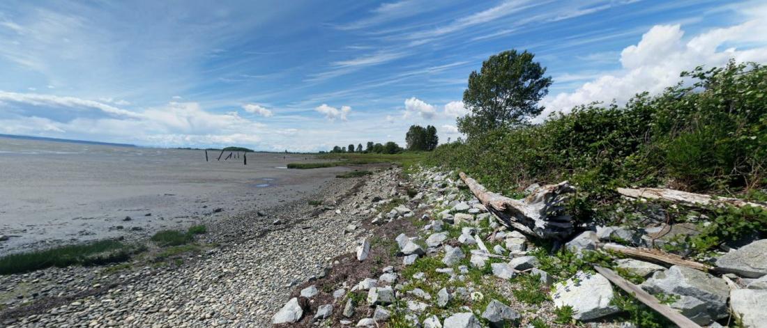
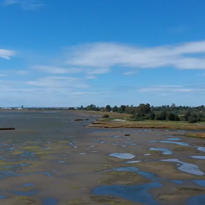
As the climate changes, coastal areas everywhere can expect more frequent and severe flooding from storm surges and sea level rise. In Surrey, over 2,500 people will be affected in residential areas and neighbourhoods in and around Crescent Beach, Panorama/Gray Creek, Cloverdale, Inter-River Area, Colebrook, Mud Bay, Nico-Wynd/Crescent Road and Semiahmoo First Nation. The coastal floodplain area spans 20% of Surrey’s land.
To help our coastal communities become more resilient, the City developed a Coastal Flood Adaptation Strategy (CFAS) for Surrey’s coastal floodplain area. CFAS took a participatory, community-driven planning approach directly engaging residents, stakeholders, and other partners, including First Nations, community and environmental organizations, business associations and groups, senior governments, farmers, the agricultural community, and neighbouring jurisdictions to identify short, medium and long-term options to adapt.
CFAS Area
Explore the history and future of Surrey’s coastal floodplain. Learn how coastal flooding impacts environment, communities and people, agriculture, infrastructure, and culture through our interactive storymap or this descriptive video.
Public Consultation & Workshops
CFAS engaged with residents, stakeholders and partners since 2016. The results of this participatory planning process are summarized in the project Engagement Report for Phases 1-3. Highlights of the engagement included:
- 100,000+ Social Media Impressions
- 1,750+ online surveys completed
- 500+ worksheets completed
- 200+ Surrey Youth Engaged
- 200+ Community Conversations
- 8 Pop-up Project Outreach Stations throughout Surrey
- 7 Technical workshops
- 5 Crescent Beach Workshops
- 3 Sector Based Focus Groups
- 3 Project Advisory Group Workshops
- 2 Project Open Houses
- 2 Coastal Site Tours
- 1 Wrap-up Event
The April 2018 Open House summarized the findings of Phase 2 and 3, and a subsequent update is available in the 2018 CFAS Year End Update Presentation.
The CFAS Strategy Summary Document and CFAS Final Strategy Document were shared at the Wrap-up Event in November 2019.
To hear stories from our residents and stakeholders, see the CFAS YouTube Playlist.
Process
The CFAS project was broken into five phases illustrated below along with a general project timeline. The inclusive, participatory approach was the foundation in each of the five project phases and ensured we developed a set of preferred strategies that were robust, transparent and defensible.
- Completed
- Started
- Pending
Phase 1: What matters most and who is affected?
This phase developed hazard communication materials to communicate current and future flood risks across the study area to all stakeholder group. A series of workshops, an online survey and an open house helped identify preliminary community values to support the evaluation of flood protection alternatives.
Phase 2 and 3: What can we do and what is acceptable
In this phase, adaptation options are envisioned, refined and evaluated. This is a highly technical phase to assess the appropriateness of a wide range of adaptation options across engineering, economic, social, cultural and ecological indicators. Adaptation strategies are being refined with stakeholder and partner input. A project Advisory Group of more than 30 organizations was established to assist in refining strategies and refining options.
Phase 4: How will we do it?
In this phase, a small number of robust, broadly supported adaptation strategies with phasing are refined into preferred strategies based on cost, funding and partnerships.
Also as part of this phase, working closely with potential partners, City of Surrey submitted a $76.6M funding request to the federal government, under the Disaster Mitigation and Adaptation Fund to implement priority coastal flood adaptation works.
On May 24, 2019, the Government of Canada confirmed a $76.6M investment to help implement a comprehensive flood adaptation strategy that will increase flood resilience and protect over 125,000 residents, homes and businesses who are at high risk of coastal flooding. This funding will help build, rehabilitate and expand 13 infrastructure assets in Surrey and surrounding communities.
To close out phase 4, a Draft Strategy Document for the Surrey Coastal Flood Adaptation Strategy was endorsed by Council in July 2019.
Phase 5: Reporting back
In this phase, the Draft Strategy Document for the Surrey Coastal Flood Adaptation Strategy was shared with the public for feedback.
The Final Strategy Document for the Surrey Coastal Flood Adaptation Strategy was endorsed by Council in November 2019.
A Wrap-up Event was hosted on November 28, 2019. The final project materials, including the CFAS Final Strategy Document and CFAS Strategy Summary, were circulated.
Background
In Surrey lowlands, multiple components of a flood control system work together to manage coastal flooding. The animation below illustrates how the land is at a higher risk of being flooded when high ocean levels coincide with heavy rainfall, together putting a strain on the flood control system.
To learn more about coastal flooding, see the CFAS Primer Part 1: Coastal Flooding in Surrey, or watch a short video on Coastal Flood Management in Surrey.
Review additional background information and resources.
Acknowledgments
This work is funded in part by grants from the Federation of Canadian Municipalities (FCM) Municipalities for Climate Innovation Program. We thank them for the support that makes this work possible.
Contact CFAS
For more information, contact Matt Osler, Project Engineer, City of Surrey at coastal@surrey.ca or 604-591-4657.