Fleetwood Plan
We are creating a new Plan for Fleetwood. Head over to the Fleetwood Plan Engagement page to learn more. Share your input as part of the Stage 2 Plan process.
Project Update
On October 16, 2023, Council endorsed the Fleetwood Stage 1 Plan updates, including amendments to land use, transportation, parks and open space concepts.
The Stage 1 Plan for Fleetwood was endorsed by Surrey City Council on March 7, 2022. The Fleetwood Plan will help plan for growth as the community changes and SkyTrain extends along Fraser Highway. Stage 2 Planning is now underway to develop a servicing and financial plan and fine-tune land uses.
Key Documents
- Stage 1 Fleetwood Plan
- Stage 1 Fleetwood Plan Corporate Report R049
- Fleetwood Plan Update Corporate Report R162
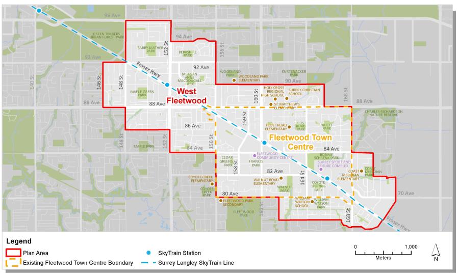
Plan Area
The Fleetwood Plan Area stretches from Green Timbers Urban Forest in the west towards the Agricultural Land Reserve in the east.
Contact Information
Amelia Bowden, Community Planner
Community Planning Division
Phone: 604-591-4643
Email: fleetwoodplan@surrey.ca