Mud Bay Nature-based Foreshore Enhancements
Learn about Surrey's innovative and green approach to managing coastal flooding.
Project description
With the anticipated impacts of climate change and a rising sea level, the City developed a Coastal Flood Adaptation Strategy (CFAS) to help Surrey become more resilient to coastal flooding including reinforcing dykes and adapting critical infrastructure. This process entailed extensive community consultation from 2016 to 2019.
The Mud Bay Nature-based Foreshore Enhancements Project is one of the recommended actions in CFAS. It will help protect Surrey’s residents, farms, critical infrastructure including Highway 99, BNSF Railway, regional power and sewer lines, and internationally recognized bird and wildlife habitats from sea level rise.
It is part of Surrey's Disaster Mitigation and Adaptation Fund (DMAF) Program which consists of 13 coastal flood adaptation projects that received a funding investment of over $76 million from the Government of Canada's Disaster Mitigation and Adaptation Fund. All projects must be completed by end of 2027 to receive funding.
The Mud Bay Nature-based Foreshore Enhancements Project is a partnership between City of Surrey, City of Delta and Semiahmoo First Nation. The project involves a nature-based approach to flood protection known as a living dyke. The project will begin with Pilot Studies to test stabilization techniques for the living dyke in two locations in Mud Bay.
Watch a video to learn more about the project.
Project location
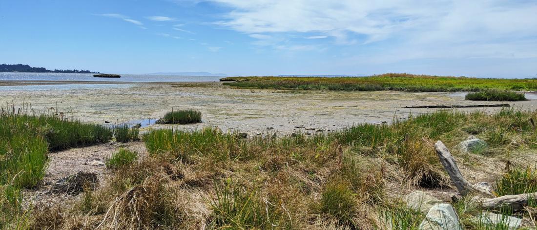
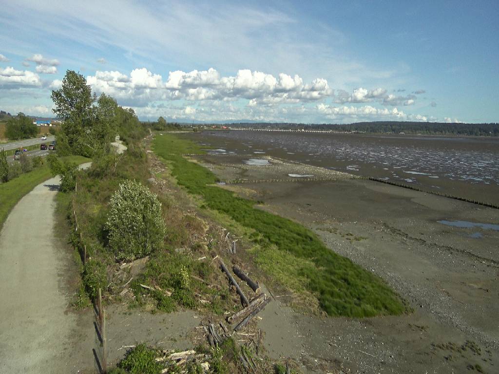
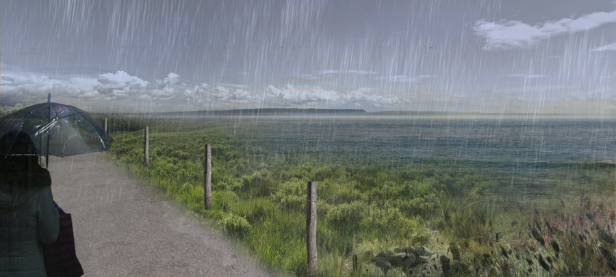
We will build the Living Dyke in Mud Bay, immediately south of Highway 99, by Mud Bay Park and the Boundary Bay Dyke Trail.
The Living Dyke will be created within the core territory of Semiahmoo First Nation and the traditional territories of the Katzie, Kwantlen, Sto:lo, and Tsawwassen First Nations.
We plan to first pilot the living dyke concept at two locations. One in front of the Boundary Bay Dyke in Delta (not shown on the map), and the other on the shore immediately west of Mud Bay Park in Surrey. The Living Dyke will extend along the shoreline for a combined length of approximately 790m of linear shoreline.
View a project map that shows the location of two pilot project areas.
Project timing
Times are estimates and are subject to change.
- Completed
- Started
- Pending
Planning, design, Environmental Assessment
Community Engagement
The public will have an opportunity to provide feedback on the Project to the BC Environmental Assessment Office as part of early engagement.
BC Environmental Assessment Review process:
Public Comment Period (Jan 11 – Feb 27):
- View open house information boards
- View public comments
EA Exemption Certificate Decision expected: early 2024
Work begins at the Delta and Surrey Living Dyke pilot sites
Work takes place on Surrey Living Dyke site
We anticipate the next phase of construction to start spring 2024.
Construction schedule will be based on tides, season, applicable work windows and sequence.
Project design
The Living Dyke solution
A living dyke uses nature to provide flood protection. The concept is based on the idea of establishing a gentle, raised slope to help natural marshes keep up with sea level rise. Our goal is to help the marsh lining Boundary Bay adapt to one metre of sea level rise.
Building the Living Dyke
The City will add sediment and plant native salt marsh species on the foreshore. We will plant more marsh over time to gradually increase the elevation of the Living Dyke.
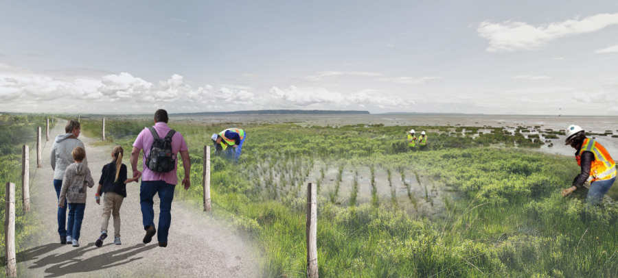
We are working with City of Delta to test the living dyke concept in two smaller Pilot Studies. The results and lessons learned from the Pilot Studies will be used to inform the design and construction of the Living Dyke in Surrey.
We will follow an adaptive management approach and continue to monitor the site over time and make adjustments as needed.
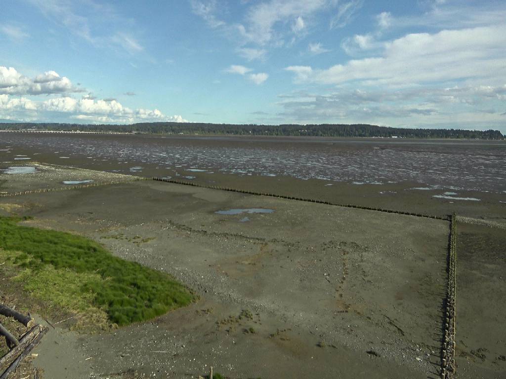
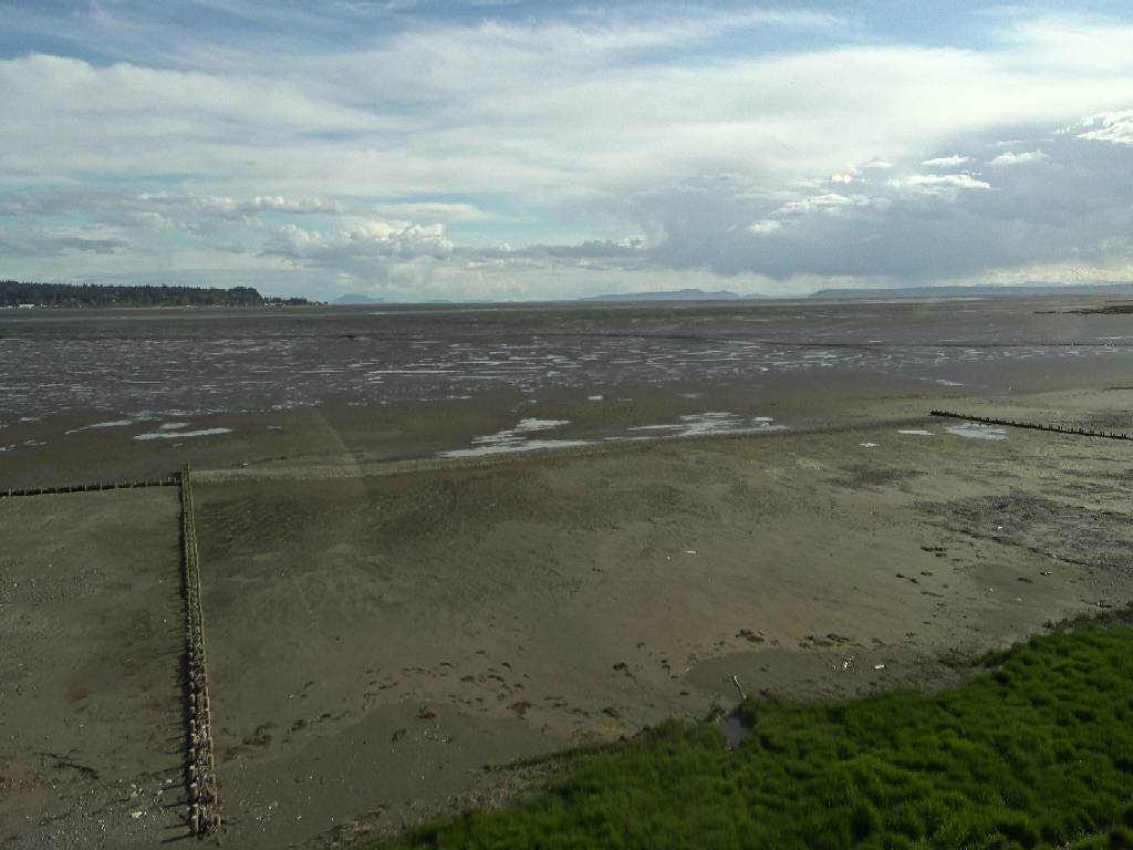
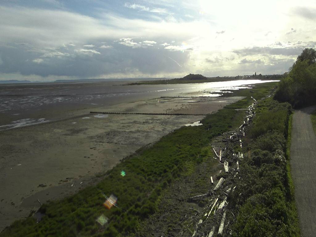
See the Living Dyke grow in real time
Images are updated every 10 minutes.
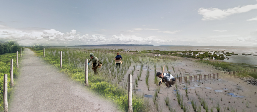
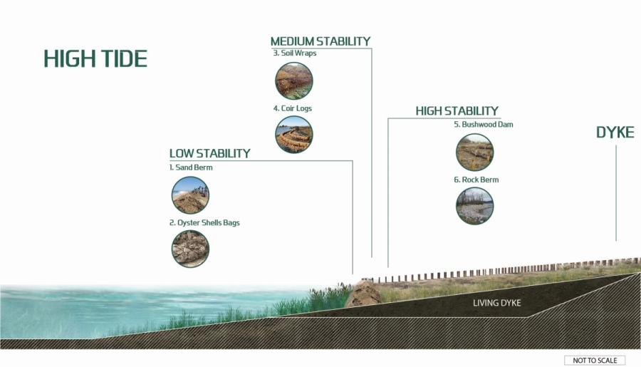
Stabilization techniques
We will test the various stabilization techniques listed and shown below during the Pilot Studies. The successful stabilization techniques will be used when constructing the larger Living Dyke in Surrey.
- sand berms
- oyster shell bags
- soil wraps
- coir logs
- brushwood dams
- rock berms
Project benefits
Mud Bay is vulnerable to impacts from climate change, including rising sea and groundwater levels, coastal squeeze of ecosystems (i.e., salt marshes), increased shoreline erosion, saltwater intrusion, more extreme floods, and increased risk of dyke breaching.
The Living Dyke will help reduce these impacts and provide the following benefits to Surrey:
Provide a nature-based defense to coastal flooding
The Living Dyke will include the planting of salt marsh vegetation. Salt marshes provide flood protection by decreasing the size of waves, storing water, and reducing coastal erosion.
During an extreme storm, the salt marsh will be able to slow down the waves and reduce their height and impact on the coast. The Living Dyke will help protect residents, farms, Highway 99, BNSF Railway, regional power and sewer lines, from coastal flooding.
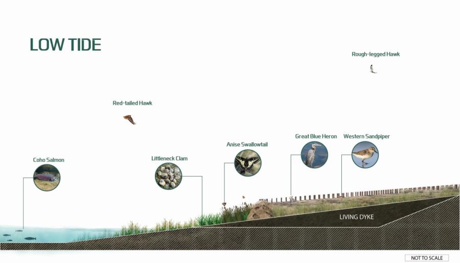
Build natural habitat and enhance biodiversity
Mud Bay consists of unique habitats including mud flats, eelgrass beds, and salt marshes. This estuary ecosystem supports migratory birds, salmon, seals and other marine life. The living dyke will increase the natural habitat in Mud Bay so that wildlife can continue to thrive.
The image below shows the variety of birds and other wildlife in Mud Bay that would be supported by the Living Dyke.
Prevent marsh habitat from disappearing with sea level rise
Salt marsh are very valuable for flood protection, improving water quality, storing carbon, and supporting our wildlife. With rising sea levels, the coastal marshes that we depend on are at risk of disappearing due to coastal squeeze.
In the past, if sea levels rose, coastal marshes were able to move further inland. But in Mud Bay, Highway 99 and the existing dyke prevent salt marshes from migrating to higher grounds. If these habitats disappear, the small fish, insects and invertebrates that support birds and larger predatory animals – like salmon and seals – will also be impacted. The Living Dyke will help these coastal marshes remain healthy.
Increase our understanding of viable coastal marsh adaptation approaches
The Living Dyke will improve our understanding of techniques for marshland construction and the preservation of salt marsh habitat that can be replicated at a larger scale and be used by other coastal municipalities across BC and beyond. A living dyke is a more sustainable approach to adapting to climate change and sea level rise.
Environmental assessment
Due to the size of the Living Dyke (over 7 hectares), the Project is considered reviewable under the BC Environmental Assessment Act. The Pilot Studies are not reviewable because of their smaller size that do not meet the threshold under the Reviewable Projects Regulation.
The purpose of an environmental assessment is to identify and mitigate potential impacts of major projects and to seek consensus with participating Indigenous governments. Projects that are unlikely to cause significant adverse effects or serious impacts to Indigenous Interests may be exempted from a longer and more comprehensive environmental assessment process.
The City is seeking an Environmental Assessment Certificate (EAC) Exemption Order due to the restorative nature of the Project and its low likelihood of causing significant adverse effects. Additional permits and approvals would still be required.
The City has also been seeking input from First Nations and meeting regularly with Semiahmoo First Nation on the living dyke.
Indigenous interests
The Living Dyke is within the core territory of Semiahmoo First Nation, the traditional territories of the Katzie, Kwantlen, Sto:lo, and Tsawwassen First Nations, and may be of interest to other Indigenous nations and organizations. The City is committed to working with all interested First Nations on the Living Dyke to ensure concerns are addressed. Semiahmoo First Nation is a partner on this project.
Below lists the City’s efforts to date working with Indigenous nations:
- Sought input from Indigenous nations through its’ Disaster and Adaptation Mitigation Adaptation Program (DMAF), which consists of 13 Coastal Adaptation Projects, and during the development of the City’s Coastal Flood Adaptation Strategy (CFAS, 2016 - 2019).
- Meeting with Semiahmoo First Nation on a bi-weekly basis since May 2021 to discuss DMAF projects including the Mud Bay Living Dyke.
- Regular meetings with the Boundary Bay Living Dyke Roundtable, which includes representation from First Nations.
-
Frequent ‘Living Dyke Core Group Meetings’ with Semiahmoo First Nation.
-
Circulated 50% and 90% Pilot site design for comment to 20 First Nations.
-
City provides regular updates and meets with First Nations, as requested to discuss projects. City has met separately with Semiahmoo, Kwantlen, Katzie, and Tsawwassen First Nations to date.
Engagement & collaboration
Project information and updates will be provided on this webpage. If you would like email updates, sign up for the CFAS newsletter. The signup form is at the bottom of this page. We generally only send out 1-3 newsletter emails a year.
Province's Public Comment Period
The public will have an opportunity to provide feedback on the Project to the BC Environment Assessment Office, as part of the early engagement phase of the Environmental Assessment permitting process.
The BC EA Public Comment Period runs from Jan 11 - Feb 27, 2023. Provide feedback or attend an Open House.
Navigable Waters Comment Period
Under the Canadian Navigable Waters Act, notices were posted on the Surrey and the Delta sites:
Surrey's preliminary engagement
During the development of Surrey's Coastal Flood Adaptation Strategy (CFAS) from 2016 - 2019, and the Surrey's DMAF Program of 13 Coastal Flood Adaptation Projects, the City has engaged with relevant stakeholders, Indigenous nations, regulators, land owners, and the public on issues facing Surrey's coastal floodplain.
During this preliminary engagement, key interests, values, and concerns around Mud Bay were identified, considered, and incorporated into the development of the Mud Bay Nature-based Foreshore Enhancements Project.
Boundary Bay Living Dike Roundtable
The living dyke concept for Mud Bay was first discussed during the CFAS process and refined further through a collaborative working group called the Boundary Bay Living Dike Roundtable (the Roundtable), which was created in 2018. The Roundtable consists of representatives from Indigenous nations, environmental regulators, coastal engineering experts, municipal staff, and researchers. Participation in the Roundtable is voluntary, and its objectives include information sharing, technical dialogue, and relationship building.
The City will continue to work closely with the Roundtable for input on construction, monitoring, and evaluation of the Living Dyke.
News & resources
- Wednesday, June 7, 2023 - Surrey and Partners Plant ‘Living Dyke’ on Mud Bay Shoreline
- Tuesday, October 4, 2022 - Surrey Investing in Dyke Upgrades to Protect Against Flood and Storm Events
- May 13 to June 24, 2020 - Council Committees and Commissions Presentations
Contact
For more information about this project, please contact coastal@surrey.ca.
This project is funded in part by the Government of Canada through the Disaster Mitigation and Adaptation Fund.