152 Street Road Upgrades
The City is upgrading 152 Street in the lowlands to increase flood protection, traffic flow and travel options.
Project Description
The City plans to raise and widen 152 Street between the Serpentine and Nicomekl Rivers to increase flood protection, traffic movement, and travel options.
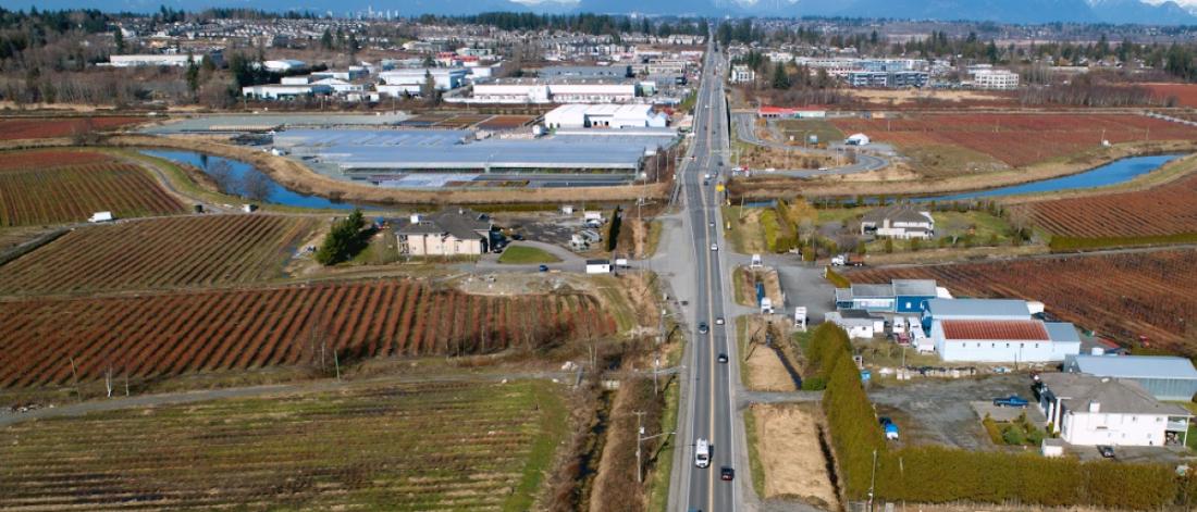
This section of 152 Street between the Serpentine and Nicomekl Rivers is currently 2 lanes and built on grade in the floodplain. This section does not include any paths for walking or cycling.
Summary of Improvements
152 Street Upgrades will include the following improvements:
- Road raising for greater flood protection
- Road widening to increase vehicle lanes from 2 to 4 lanes to keep traffic moving
- Upgrading transit stops and bus shelters to increase safety and access to transit
- Adding multiuse path for cycling and walking to provide sustainable travel options
- Twinning of Nicomekl River Bridge crossing to improve traffic movement
Project Update
Take a drive with us to see how the project is progressing as of November 2023:
Preliminary Design
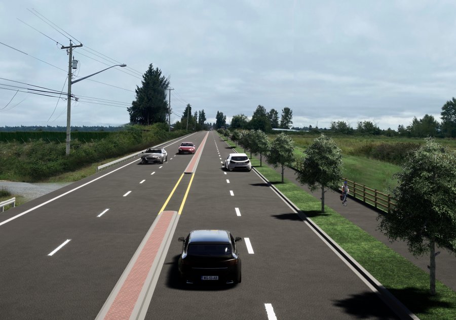
Above is an artistic rendering of 152 Street road improvements. There may be further minor changes to the design.
What will this project achieve?
152 Street is a key transportation corridor linking North and South Surrey.
152 Street supports approximately 21,800 vehicles per day and more than 5,150 public transit commuters travel this road daily. It is part of TransLink’s Major Road Network and serves as a key corridor for goods movement and emergency response.
This section of 152nd Street is a high risk for flood hazards. With our changing climate, stormy weather events are becoming more frequent. A significant flood along this section would have major economic impact, restrict the region’s ability to respond to emergencies and impact the flow of vehicles and people.
Upgrades to 152 Street will provide the following benefits:
- keep our communities safe in case the coastal dykes breach during an extreme flood. This project is part of the first phase of implementation of Surrey's Coastal Flood Adaptation Strategy to build community resilience to coastal flooding and sea level rise.
- provide sustainable travel options with a multiuse path for cycling and walking
- Improve traffic movement and reduce travel times with 4 lanes
- prepare for future growth with additional lanes and multiuse path for walking/cycling
- improve emergency response times
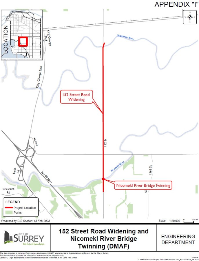
Project Location
Project Timing
We will begin construction in spring 2023. We anticipate construction of road upgrades and the bridge twinning to be complete 2025/26.
Resources:
- 152 Street Road Upgrades Project Breaks Ground (News Release, June 13, 2023)
Contact
For more information about this project, contact Tindi Sekhon, City of Surrey Project Lead at 604-591-4765
or thsekhon@surrey.ca.
This project is funded in part by the Government of Canada through the Disaster Mitigation and Adaptation Fund.