Clayton Corridor Plan
As SkyTrain extends along Fraser from Fleetwood to Langley, we are updating land use plans around future SkyTrain stations in the Clayton Corridor.
We are conducting a planning study for Clayton Corridor and the adjacent Clayton neighbourhoods along Fraser Highway. This project will support the enhancement of Transit Supportive Development and Clayton as an emerging urban centre. It will also result in a plan to manage growth in surrounding neighbourhoods in Clayton as SkyTrain extends down Fraser Highway.
The plan is being developed in partnership with residents, stakeholders, and public agencies to achieve desired community objectives such as more green space, an enhanced public realm, affordable housing, and a village centre.
Plan Area
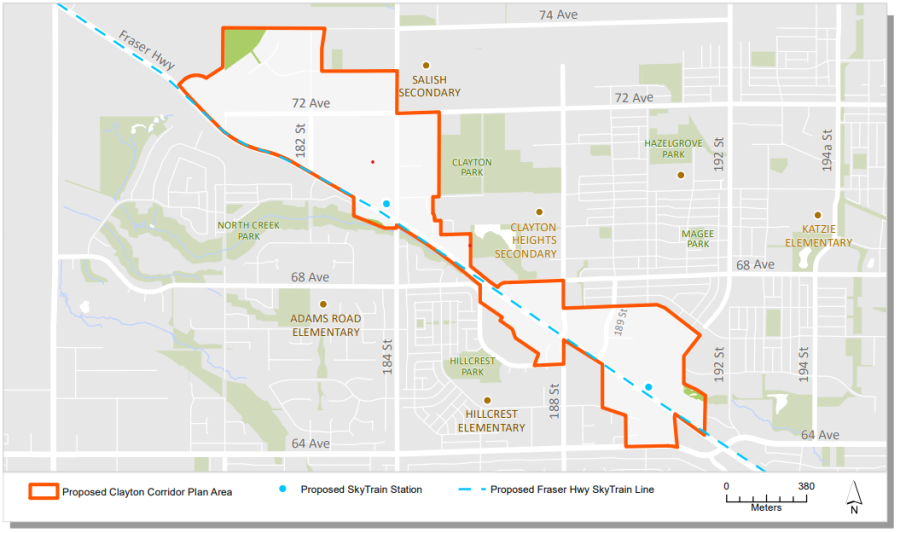
The draft plan area contains two future SkyTrain stations and is centered on Fraser Highway. It runs from the edge of the Agricultural Land Reserve in the West to 192 Street in the East. The plan area boundary will be refined through the planning process.
Background Information
The Clayton Corridor contains a variety existing of neighbourhood plans throughout areas of East Clayton, West Clayton, and North Cloverdale.
In 2019, Council recognized the need to update land use plans in this area, and authorized staff to undertake a planning process for the Clayton Corridor (Corporate Report R059).
On March 28, 2022, Council identified that the Clayton Corridor Plan would begin following the adoption of the Fleetwood Stage 1 Plan. The Clayton Corridor Plan is tentatively targeted to be brought forward for Council consideration in 2024 (Corporate Report R061).
Contact Information
Amelia Bowden, Community Planner
Community Planning Division
Phone: 604-591-4643
Email: claytoncorridor@surrey.ca