Newton-King George Boulevard Plan
Review the Land Use Plan for the Newton-King George Boulevard Neighborhood
The Newton-King George Boulevard Plan was approved by Council on March 6, 2023. The plan provides a framework for growth, redevelopment, and community investment for the next 15-30 years. Development applications consistent with the approved plan may now be considered in the area. Residents will continue to have an opportunity to comment on rezoning applications on a project-by-project basis through the development process.
Key Documents
Plan Area
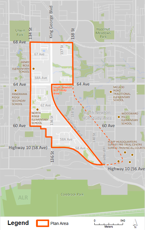
The Newton–King George Boulevard Plan Area comprises approximately 167 hectares (413 acres) of land between Highway 10 and 68 Avenue. The Plan Area is centered on the western side of King George Boulevard and is surrounded by existing plans to the north (Newton Town Centre Plan) and east (South Newton Neighbourhood Concept Plan)
Background Information
On March 6, 2023, Council endorsed Corporate Report R027 which concluded the planning process and approved the Newton-King George Boulevard Plan. A summary of the community engagement undertaken from 2022-2023 are outlined in the Engagement Summary.
In October 2020, Council endorsed Corporate Report R156 to amend the plan area boundary.
In October 2019, Council endorsed Corporate Report R207 to initiate the planning process for Newton-King George Boulevard.
Contact Information
Planning & Development
planningdevelopment@surrey.ca
604-591-4448
Are you considering developing or rezoning? The first step is a Pre-Application Meeting.